
Climate-Adaptive Design Studio Event on Sept 9, 2022
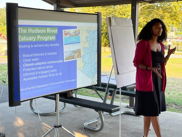
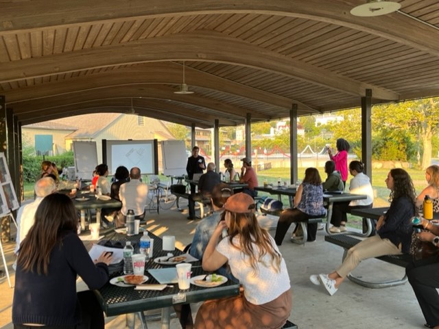
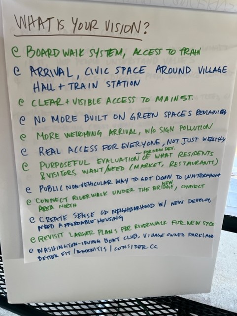
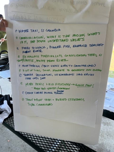
On September 9th at the Pierson Park Picnic Pavilion, Landscape Architecture students from Cornell University met with Village residents to talk about the future of the Tarrytown waterfront and the challenges of climate change. With the impact of flooding and inundation already felt at Village properties during extreme weather events, residents discussed concerns about how to protect Village resources and plan for the future. At the same time they discussed visions for the waterfront and the areas connecting the river to the heart of downtown.
These are the presentation slides from the September 9th meetings that include information about flood projections through 2080 and potential estimated costs for the Village associated with future storm damage.
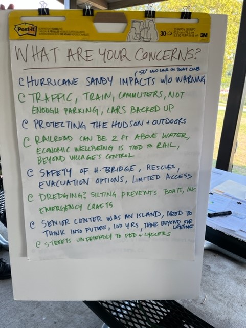
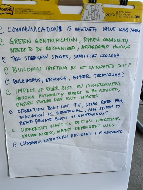
This summary of the meeting discussions reflects both concerns about and visions for the Village waterfront from community members.
This free online mapping tool sponsored by Scenic Hudson allows you to see impacts on our shoreline for different ranges of projected sea level rise.
Some of the other tools used by the DEC and Cornell to estimate costs and impact of seal level rise:
The Columbia University Hudson River Decision Support System Tool:
http://www.ciesin.columbia.edu/hudson-river-flood-map/
Sea Level Affecting Marshes Modelling Tool (SLAMM):
https://longislandsoundstudy.net/research-monitoring/slamm/
The above resources are models so they are not precise, but can help us estimate what may be possible in the future.